|
GIS for
Planning and Monitoring
of Works under NREGS
NREGS Planning
Planning is the most essential part of successful and result-oriented
implementation of any scheme or plan. The National Rural Employment
Guarantee Scheme (NREGS) has a broad horizon and high promises; in this
vision the government is investing a majority of its finances in this
particular scheme. Considering the high expectations and investments,
planning becomes most vital for this particular scheme. A key indicator
of success is the timely generation of employment within 15 days while
ensuring that the design and selection of works ensure development of
good quality assets. The need to act within a time limit necessitates
advance planning.
The process of planning has been laid down under the Section 16 of the
Act, giving it the power to make recommendations on the works to be
taken up under NREGA to the Gram Sabha and the power to prepare a
development plan comprising a shelf of projects on the basis of these
recommendations of the Gram Sabha to the Gram Panchayat. The Gram
Panchayat has to forward the development plan with its priorities to the
Programme Officer for preliminary scrutiny and approval prior to the
commencement of the year in which it is proposed to be executed.
Generally, a Perspective Plan of any District has the following
features:
• Village-based: with the village as the unit for planning
• Holistic: attempt to cover all aspects of natural resource management
along with socio-economic infrastructure requirements so as to identify
all the critical aspects of development in the local areas
• Diagnostic: includes a causal analysis of poverty. This will help
identify gaps and needs, and indicate the nature of interventions
required
• Finalise the works that can be included under NREGA
• Delineate baselines
• Indicate outcome-based strategies
• Indicate the methods for measurement of outcomes
• Identify the existing programmes and financial resources and assess
the additional resources required
Gaps in the Current Planning Process of NREGS
• Planning by the high stakeholders: The higher stakeholders do not have
featured resource databases. Although there are a number of processes
mentioned for streamlining the planning process, a holistic vision at
each level is missing. Planning at the Gram Panchayat level is supposed
to be done in the
 Gram
Sabha, which is actually done by the block level officials at some
places and by the Secretary or Sarpanch / Mukhiya at others. It is found
that the majority of the plans are prepared by the higher stakeholders
who need a detailed resource data base available Gram
Sabha, which is actually done by the block level officials at some
places and by the Secretary or Sarpanch / Mukhiya at others. It is found
that the majority of the plans are prepared by the higher stakeholders
who need a detailed resource data base available
• Consolidation of resource database: One of the important factors that
hinders effective planning of works under NREGS is non-availability of a
consolidated resource base at the district or block level. The current
portfolio of resource database exists in files of different departments,
including the forest department and the minor-irrigation department.
They have a department-specific resource database that is rarely
accessible to the larger audience. Thus, this affects effective planning
as well as coordinated action under NREGS. This has been seen as an
important area that needs attention.
GIS and its Promises for Enhanced Planning and Monitoring
The Geographic Information System (GIS) is a computer-based tool for
mapping and analysing geographic phenomenon that exist - and events that
occur - on Earth. GIS technology integrates common database operations
such as query and statistical analyses with the unique visualisation and
geographic analysis benefits offered by the maps. These abilities
distinguish GIS from other information systems and make it valuable to a
wide range of public and private enterprises for explaining events,
predicting outcomes, and planning strategies. In general, a GIS provides
facilities for data capture, data management, data manipulation and
analysis, and the presentation of results in both graphic and report
form, with a particular emphasis upon preserving and utilising inherent
characteristics of spatial data.
GIS is not just a map making tool. It is primarily an analytical tool
that provides new ways of looking at data, and linking and analysing
data by projecting tabular data into maps and integrating them from
different, diverse sources.
Broadly, GIS is able to:
• Collect and consolidate information on the existing natural and
physical resources of the villages
• Support the comprehensive village planning and to identify the
potential areas for creation of sustainable livelihoods through the
Convergent Action Plan
• Facilitate ready development of shelf-of-project aiding sustained
employment opportunities in the region
• Re-focus on creating/improving livelihoods assets which, of late, has
been a missing link in NREGS
Experiences with GIS for Planning in NREGS
GIS-based resource maps are already prepared for a few locations in
Bihar, Uttar Pradesh and Madhya Pradesh under the various Projects. A
scoping study undertaken by DA for designing an Alternative
Implementation Model of NREGS in Bihar along with the Government of
Bihar and the World Bank, a GIS-based decision support system was
developed for the village Padhauti in Bhagwanpur Block. The internal
infrastructure available with DA was used for GIS-enabled plotting of
resources and the manifestation at this level of study definitely
appears to be confined but has strong futuristic orientation.
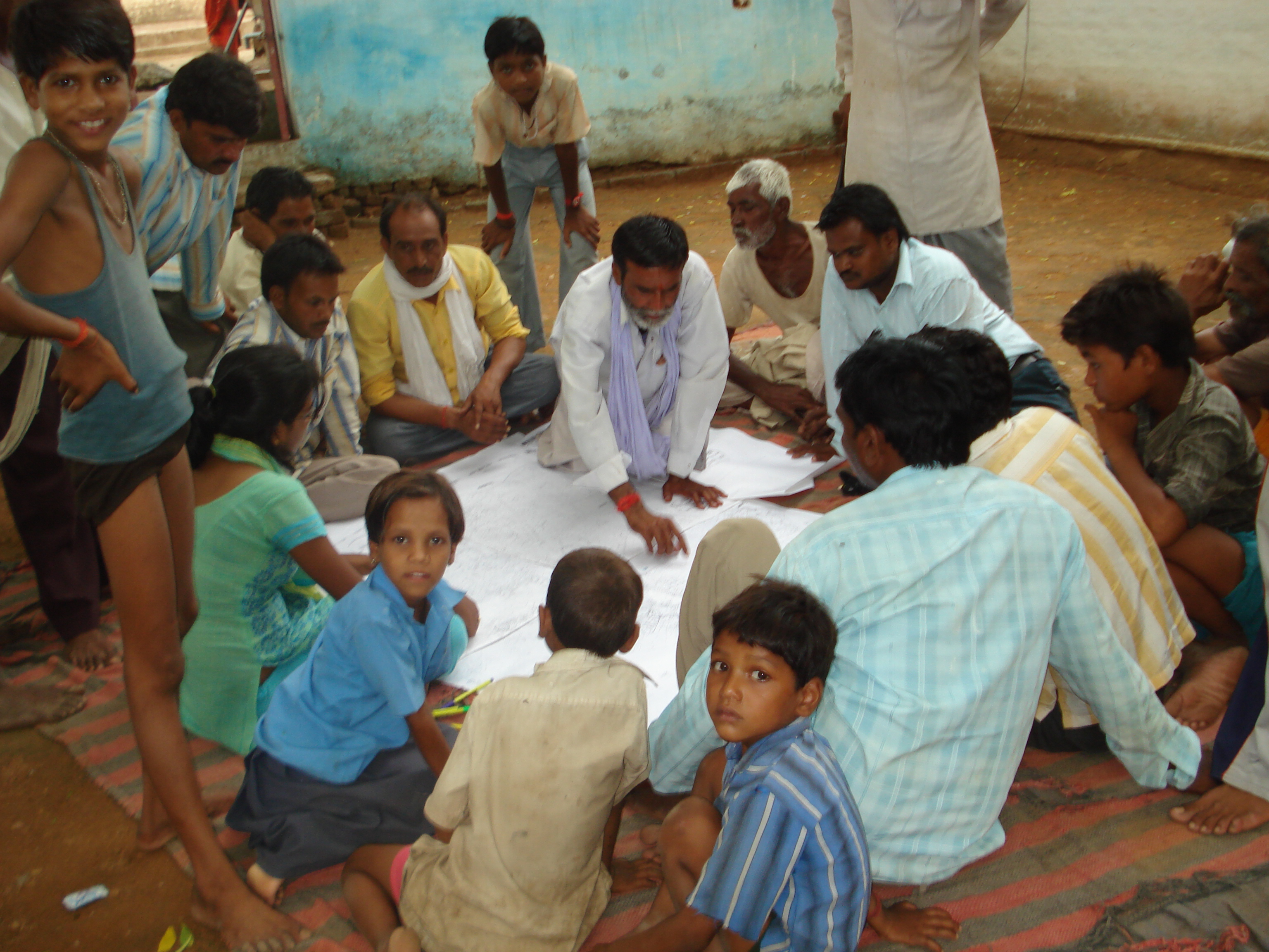
It is worth mentioning the manner in which the exercise was used
intensively in making the Sample Shelf of Project for a Gram Panchayat.
During the participatory exercise for identification of works in the
Panchayat, its categorisation on basis of their nature and its
prioritisation on the basis of village need, the resource maps proved to
be a visual reckoner for the villagers and PRIs. Similarly, it was also
used in the UNDP - NREGS+ Project in Bundelkhand (Uttar Pradesh and
Madhya Pradesh) in which we are piloting innovations under NREGS. The
process flow adopted is as mentioned above. The findings clearly show
the differences in the resource availability in the two distinct
districts.
Pros and Cons of the GIS-based Decision Support System
GIS can be used to assimilate both spatial and non-spatial data.
Projecting the available natural resource information on maps will
enhance decision making regarding which resource area needs to be
developed and conserved and bringing them under the umbrella of NREGA.
It can also help in projecting the spatial Impact of the activities
covered by NREGA. GIS-based maps can also aid the policy makers in
making decisions on current and future course of work and will give an
analytical tool for sharing information, identification of potential
areas of work, planning, monitoring and management. GIS-enabled systems
strengthen the planning process and also support strengthening of
monitoring and evaluation mechanisms. The output, outcome and impact
level indicators can also be plotted on the GIS and can be tracked from
time to time within one interactive system.
GIS would need significant investments to establish a state-wide
facility to support pilot programmes, scale up the existing ones and may
need the department to advocate convergent action at the State level.
q
Avanindra Kumar
akumar@devalt.org
Back to Contents
|