|
Green Growth
using Planning Tool
Introduction G reen Growth is an alternative concept to standard economic growth, which uses natural resources in a sustainable manner. Quality environmental information is crucial for green growth and related decision support system. Quality environmental information can be generated through an efficient Geographic Information Systems (GIS) based information system.GIS is the key tool for
planning, management and influencing policy and decision making. GIS
offers the opportunity to gather multiple layers of information, drawn
from different sources and sectors of environment, into one spatial
representation. In our country, presently, the focus of development is
rural areas and villages. To develop these villages in a sustainable
manner there is a need for GIS-based village information system. The
emergence of GIS as a powerful tool for spatial data analysis and
storage has, in effect, transformed the planning process. GIS provides a
framework for collecting, organising and managing structured data and
arriving at a precise decision. Many different types of data can be
displayed on maps and a great deal of information can be summarised. The
visual display of information can reveal patterns and relationship that
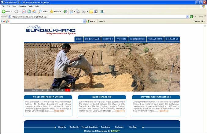
may not be apparent in tabular displays. The Development Alternatives (DA) Group has developed an information system for Bundelkhand region, which includes six districts of Madhya Pradesh and seven districts of Uttar Pradesh. This Village Information System (VIS) is a web-based information system that provides the required information to various stakeholders for arriving at a best possible decision for green growth. It provides a platform for viewing and sharing ideas of different stakeholders in particular and people in general. It is similar to a dynamic information board where you can place information and also receive queries. VIS integrates village-level spatial and non-spatial data in GIS environment into a useful informatics tool for a decentralised planning process. This assists the decision makers in planning, implementation and monitoring of various activities of development. Village level data or information on developmental indicators such as education, health, livelihoods, civic amenities and natural resources is available at a few clicks. Mathematical and logical queries based on various attributes can be carried out to get the desire results. Complete information about a village can be obtained by just clicking on the map. These GIS-based village information systems provide the planners an accurate spatial view of the district at different levels such as district, block, and village level. VIS manages all the village-related information in the GIS environment. It displays data from census and other secondary sources in the form of maps. This village database covers many themes related to socioeconomic environment and is used for rural development plans. Case Study Bundelkhand Village Information System (BVIS) is one of the planning tools to collect, collate and manage the village-related information in one place. The motto of BVIS is turning data into an interactive database for monitoring socioeconomic and environmental indicators, which is generated by integrating both spatial and non-spatial data. The vision of the BVIS during its inception is to facilitate a transparent and rational planning at the village level which can be used as a Decision Support System (DSS) and is envisaged for grassroot level planning and interventions. Village level data on different thematic areas and the resources of villages can be available at a few clicks. Complete information about a village can also be obtained by just clicking on the map. It is user-friendly with Menu/Tool Button Driven access. It enables one to generate queries from non-spatial datasets and also display the results on spatial datasets (maps). The natural resources, socioeconomic conditions, livelihood, education level, demographic pattern, health and civic amenities parameters can be displayed in the form of maps. The methodology adopted for the development of this system is to collect and analyse the existing data on socioeconomic profile, natural resources and civic amenities up to village level. All the data has been collected from secondary as well as primary sources, collated and analysed for thematic mapping. Accordingly, the layout and designing of geo-database was done. A menu-driven graphical user interface (GUI) was created and integrated with the thematic maps for easy navigation and user-friendly visualisation in decision making. The geospatial database created has been uploaded into Autodesk Map Guide Studio for developing a web-enabled interactive village information system. The software used for development of Interactive BVIS includes Arc GIS 9.3.1, for creation of geospatial database, and Autodesk Map Guide Studio for publishing data on web. The BVIS is accessible via intranet or internet browsers. It is an application that can retrieve data and provide information through a browser interface to end-users. BVIS is a cost-effective application in which the user does not have to spend on buying GIS software and maintaining them. This web-enabled BVIS can be used for monitoring and decentralised planning processes, taking into consideration the local needs and constraints. This can be used for carrying out micro level planning. This system can give the entire socio-political picture of the village and can be used for village, block, district, state and even for national level decision support system. Web-enabled BVIS provides the latest data on a click of button, thereby reducing any delay. Each relevant village location could be spotted on a block / taluka map with a unique village codification in database. The spatial utility maps have been prepared and gap analysis has been carried out to identify villages lacking in the facilities. This system can also be augmented by adding more themes. For using BVIS one does not need the knowledge of GIS functioning. The use of BVIS will help the planners in making more rational decisions in the field of sustainable development. But the human-computer interface, i.e., lack of basic computer skills in some social groups and issues of interface design needs to be addressed. q Avanindra Kumar
|